Showing posts with label 2-3/2007. Show all posts

Tuesday, April 10, 2007

Cat Cay diversion


Unlike in the U.S., old homes seem to be left standing. This was a plantation home of a slave owner..Several other smaller homes stand nearby, that long ago, belonged to his sons.


Tried heading off to Conception Island but the winds were on the nose again +/- a few degrees so I expected to tack there during daylight. Winds grew rather than moderate as expected per (Chris'Weather Report) so seas started at 4-5 then went to 7+ by noon at 15-18 true..that meant 20-23 or so accross the deck. The problemo..that we were not used to, was that at this point on the charts, the Atlantic Ocean was running free from Africa and the currents were also adding to our dilema that day. Pushing hard to windward, with rail buried to the point that we washed 2 gas cans and a 4' fender board overboard,

Father Jerome, an architect priest, built a hermitage atop the mountain at Cat Cay.

I decided to turn from the east and make way for Cat Cay-a beam reach north and a good spot to hang out for an evening..or more.
Cat Cay was very friendly, inexpensive and offered a sheltered harbor in the easterly winds. We got together with a number of other boats at a waterfront eatery that evening, bringing our own finger food to share and purchaced drinks from the establishment. The owners and staff were like family. I would love to have time to stay at this island for an extended period. They understood the 'fingerfood thing' as they have poor access to products we are used to.

The views from each one of the small windows within his downsized replica of some famous religious site (?) are all spectacular.

Some photos show us exploring up at a priests hermitage atop the nearby mountain.
Left early next morning to take advantage of shifting and easing of wind which I hoped to allow us to at least motorsail south as the winds were from the SE, then the next day turn East when the wind shifted to the South. It worked.


We again had to slow down and hove to off the island of West Caicos. got some sleep and began running SE for the turning point NE up to Provo around 4 AM. Timing was fine and arrived at Provo early on Sat. to find out that clearing in was impossible as the government shut down till Tues. morning.... Easter in the Islands! Looking around from the cockpit, the scene was sad. half the boats in the harbor were near derelict in appearance and the shoreline was lined with Mansions. At night, 9 out of 10 of these rich man retreats, had no lights on....abesentee owners. Had flown into Provo 19 years ago to crew on a passage to Jamaica and Sapodilla Bay was virgin, with the exception of one 2 story hotel on the point which also served as a cruiser hang out. The road was new, joining the 3 settlements on the island...dusty, crushed rock and a long, hot walk anywhere, but lovely in its simplicity and remoteness. Now, it came off as another beautiful spot destroyed by some with too much money. Enough.


Bought a Whole Grouper from local fisherman, then they cleaned it, fileted it and cut up the rest for a fish stew! $25. for about 10 meals for 2 people.

Motorsailed again, into the wind taking a slightly southerly route across the bank to the departure point for the southern tip of the Turks, known as Big Sand Cay. All went wonderfully, passed a bunch of buddy boaters chatting and waisting their travel time. Got off the Bank of Caicos and on towards Big Sand Cay with wind getting more favorable. Turned south at the remote cay and shut engine down from 1000 rpms. Sailing again it was glorious with a reduced jib and mizzen for power, broadreaching in 11-14 kts. of wind and doing 6+. This was my plan to arrive off Luperon in the Dominican Republic at first light.

Now anchored in Luperon harbor on the north coast of the Dominican Republic and are loving it's Old World flavor.


Farming has been mostly abandoned by the locals, now that inter island transport boats bring in supplies, but although they have been abandoned, the fields still produc
e. We stepped a few feat off the road to fill my shirt up with tomatoes and a cabbage. The corn was stunted from lack of rain.

Tuesday, March 20, 2007

Georgetown


The Exuma Sound side of the island protecting the Georgetown area is typically like this. Four to 7' seas running for 30-70 miles uniterupted.

Well, here we are in beautiful Georgetown! Photos show the beautiful natural settings that make the trip worthwhile.
Now, the rest of the story...

We got in to the harbor on the afternoon of March 16th, settling in close to town to take a look see. Later on that day, we went over to Stocking Island's Monument Beach, to anchor in a cove well protected from the Northwest to NE. We dropped the 110 Bruce and let out about 75' of chain + snubber line for shock absorbency. Around 3 a.m. we felt the boat rock to one side hard.

A wind shift with 20 or so knots was now facing our bow towards the west, a 165 deg. shift from the early evening. I turned on the instruments/radar while in the saloon and proceed to watch one big Catamaran that was way out in front of us now(behind us before the wind shift). IF he was to drag, he would be the only one I needed to be concerned about. The winds quickly went to 30, then 35, then the boat rolled hard to starboard and did not come back up. We were quickly drifting/dragging sidewards, towards the beach-not far away. I yelled for Dorothy to start the engine and I scooted up into the cockpit to try to assess our surroundings. The wind was driving the heavy rain sidewards and reducing visibility to 50-100 ft. max. As the engine started, my stern was just passing by an anchored catamaran as he was yelling to me that I still had 14' of water. Nice to know..... but within another 50', there was only 6' of water, then rocks.


We had stocked well and suplimented along the way, here frozen salmon filets from the Exuma market. Dorothy adds her touch for another wonderful meal. We do eat much pre-packaged/frozen meals which keep things simple yet tasty.


I hammered the throttle and swung the rudder hard left. The bow luckily turned into the wind and I was able to stabilize the boat just off the beach, between the cat and another boat. Until I could get our anchor's snubber loose and our anchor up we went thru minutes of raised blood pressure. Back out we went and reset the anchor as the wind moderated and the rain's chill was finally felt above the settling adrenaline levels.
Ahhh, Paradise.
The next afternoon at 2PM again a squall came through but this time from the North. We were protected, but have you ever noticed in Boating Magazines all those pretty advertisements of the new Catamarans anchored in 2' of water and virtually stepping off to the beach?


Termite nest on tree is a host for the small lizard, having lunch.


Well. It does seem that the mindset has been taken to heart and proper/safe anchoring procedures have been discarded by many of the Cat owners. Within 5 minutes 3 0r 4 cats, some over 50' in length and 25-30' wide, were scrambling to dodge the properly anchored vessels in the anchorage. Most of the cats, had 20-30' between them and their smaller sized anchor, dropped on the beach and set in the loose beach sand over..rock. The beach? ..a foot or so of very soft large granule sand over limestone. Uh huh, off they went! A half hour later, they were back in front of everyone looking to do the same darned thing, pick the perfect spot on the beach or up in front of the long set fleet. Why is it that with 70 boats in a tight anchorage, that the newcomers think the perfect spot is waiting for them "Up Front"? What's wrong with dropping the hook behind the rest so everyone can get a sound nights sleep?


Dorothy enjoyed her shelling.


OK. Two nights later. 11 PM: We are watching the movie Jazz Singer on DVD and 5 minutes from the end we feel the boat rock a bit; hear the patter of rain drops. No problem, we know how to do this, so instruments on, radar on, engine on. Out into the cockpit I go for a look see. Shit, by the time I get up there the rain is heavy and wind up to 35-40 knots. Fine, I still feel like an old pro at this so what the heck. The only problem is that now I'm soaked already, but I put on foul weather coat anyway, but now it holds the cool water "in".

Well it wasn't long until the fun started. Winds and rain went to 50, shifting 30 degrees or so abruptly. With the tall hills on both ends of the harbor right/left of us, the poor souls there were frantically trying not to slam into each other, being whipped to port, then starboard fiercely. WE, had some room, but then the winds seem to drop 5 then increase 10!!


Climbing aids were sometimes available to get up or down steep paths.


I looked off to the right and saw 3 big cats, now in a line front to rear, with the last one dragging fast. Out to the big bay he went. 30 seconds later, cat #2 followed! His spreader lights on, folks on deck trying to do whatever. With motor on, he was trying to regroup, when Cat #1 broke loose from his beach foothold! Yup, down on #2 he sped backwards. Number 2 backed down hard...in 45-55 kts. to avoid him and they danced the frantic dance of the evening, avoiding themselves and others around them. By this time the call was out on our harbor channel of 68 for everyone to light up their decks to help us identify our situation as the wind...BUILT!

David and Jill from Shubumi aboard for another get together. We really enjoyed their company as well as Jim's and Ann's. Fun Group!

Again, a few more cats dragged, one without an owner aboard, and several monohulls took to the rear. NO damage seemed to result, but many were assisting others, anchors and lines were dropped in 'retreat'. Those new to this felt a bit overwhelmed, but learned the things that must somehow, someday be learned. All ended well and many have rated it the worst such situation they have encountered.


Atop Monument Hill enjoying the view of 1/2 of the anchorage on the West side of Stocking Island, looking towards Georgetown.


Jim and Ann from 'Bees Knees'


The winds? Well, I had estimated in overwhelming surprise to Dorothy I thought it must be near 50 or 60 knots. All the reports up and down the island ranged from 60-67 and they were long lasting gusts..LONG lasting.

The "Bar", has been raised.


A shallow lake at the base of the Monument.


A quiet pool alongside one of the paths we explored with Jim and Ann.

Saturday, March 10, 2007

Black Point, Exumas,Bahamas

Eunice and Dorothy


Black Point, Exuma, Bahamas
........."Memory Rose" is shown as a green boat Icon, in the anchorage............

Made a short journey of only 7 miles or so, from Staniel to get down here to Black Point. It is a very nice/clean little community with several home style restaurants..that is a restaurant in someones home! Neat and very friendly folks. It is a real pleasure to be among folks that trust and are trustworthy. As an example. One of the restaurants here is called Loraine’s. she is busy right now so is off in her golf card doing chores. She told me before she left(I am in here to use her internet connection which she offered yesterday) that if anyone or myself wishes, the refrigerator is open/help myself/honor system.
Now, when have “you” had access to a restaurant / bar with an honor system. Doors open. Nothing locked. You are just trusted. How nice that feels and apparently, the cruisers down this far have proven their worth as humans.
Dorothy is doing laundry and I’m sitting here typing having a Guinness Stout before lunch.. cruising mentality.
The restauarant is filling, Loraine is back and smiling and chatting. Sunny blue skys, light winds, turquoise waters. Not a bad day.
Stay tuned, probably heading south to Emerald Bay, a new marina just outside of Georgetown-to await the outflow of the cruising fleet-quoted at being near 400 boats!
ron

Saturday, March 03, 2007

Shitty day in Bahamas


please note!
we have had the USUAL rare/then slow connectivity down here. I will add photos hopefully down further in Georgetown of Allens Cay's Iguanas and Waderick Wells., to THIS post.,,,sooo check back!


Crossing the Gulf Stream, a pot of coffee ended up on the galley floor. Nothing broke, just a mess. Dorothy had found it and cleaned it up quickly, but later that night on an inspection tour of the boat, I noticed coloring in the bilge water. When in D
Da Konk Mon extraordinaire! Really a nice fellow to chat with.
Nassau, the color was darker. Arrival at Allens Cay, showed m
uch darker color.

Neat Wicker work!

An inspection was in order, as the bilge pump certainly should have removed any colored water by now. Oh man. It turned out to be a leak in our sanitation pump out system. A seal between the electric motor and the big Vetus diaphragm pump, had failed and raw sewerage was spewing into a side locker, under stored contents and then off thru the engine room(under some plumbing pipes) to the bilge. Now we knew where the color was coming from.

Old sign, old man..........

A decision was made to attack the problem immediately and not put it off until a later anchorage where maybe there was access to more repair parts. This is the reason I carry so much gear aboard. I should be able to rebuild almost anything aboard. Well, I should say that I was now kicking myself in my own behind, for removing some of it from the boat to make room for more important(?) stuff. Well, I thought I had enough to do some kind of repair.
The system had been built in 1993, using PVC plumbing parts for virtually everything. All of that was still in fine condition, but this seal, was from a Dutch product and probably sized in some metric configuration that I would never have aboard, so removal of the pump and motor and then closing off the lines or jury rigging something in its place was the shitty job of the day. Valves had been installed in the original 1993 project to allow breakdown and removal of this pump if I ever had to and I'm so glad now that I had installed them. Closing the valves allowed me to disassemble everything with less than a gallon more liquid entering the work scene. We were really surprised that the odor was not too bad. but we had used a chemical we had found to really work well for containing Holding Tank Odors and was a biodegradable enzyme that is harmless.....it, just eats that brown stuff, then dies.


Dont bother with building WiFi Directional antennas or buying amps........they don't have anything to lock into down here. They want your Ten Bucks and unless you sign up, you go no where mon.
The Main Doors of Atlantis:

Back to the problem; the pump was disassembled to note that a big nut, that hold all the internal diaphragm parts to the pump shaft had broken and a quick fix was not at hand, so all was removed and our boxes of plumbing parts came out to see what we had to effect a repair. A short length of 1.25" PVC and a couple of No Hubs(a short rubber repair tube any good plumber has in his bag of tricks) were quickly recog
nized as part of the Fix. Next, I thought we had a spare mechanical bilge pump. Nope, we had sold the spare in a Nautical Flea market, to give us space for more important(?) stuff. Ok, I then removed part of another locker gaining access to the emergency bilge pump/removed it as I have 3 electric ones in place before it would be necessary/ and used the mechanical diaphragm Henderson pump-the No Hubs and the 1.25" PVC to replace the leaking Vetus pump. After all was connected and after Dorothy volunteered to do a clean up of the area first, we assembled everything and pumped out both holding tanks completely. Now we had fixed the leak and emptied both tanks. We like to hold all sewerage in holding tanks until we can either have them pumped out our we are at sea and can release the contents far from shore and now we again had a working system.
Job done, we sailed the next morning at first light, to Waderick Wells, a few islands south. Photo on left of a beautiful sunset behind us is proof enough. Dreams are worth the effort.
Ron Sheridan and Dorothy Knight
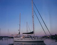
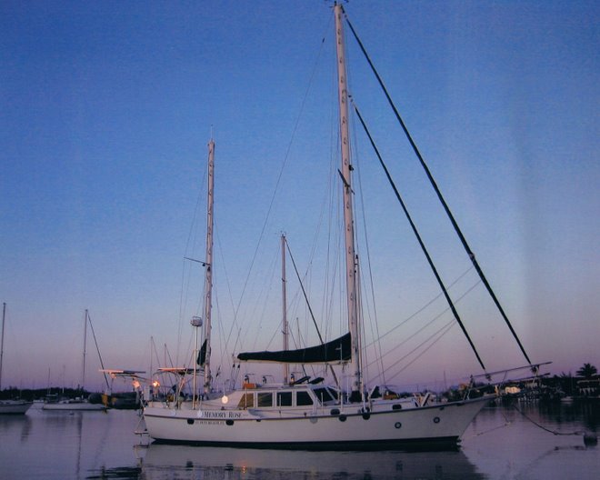
SV MEMORY ROSE/CSY 44 PILOTHOUSE KETCH

Wednesday, February 28, 2007

Down Island

We have made good time and have had the weather surprisingly reasonable for this time of year. I took advantage of an opening weather window and left Marathon's Boot Key Harbor as the winds were still from the NE. Now as any sailor knows, winds from any part of the North can make the Gulf Stream miserable and maybe dangerous. We had fueled up as we left on the high tide, and anchored outside the harbor on the SE tip of the island. At 5PM the anchor was raised and we headed out at 125 degrees(near SE) to get off the shelf of Hawk Channel and past the reef and crab and lobster pots. I was glad I decided to do this with some daylight available because I had to dodge the floats for these traps all the way out to 205' of water on the edge of Florida Straits. Once beyond that we were motor sailing into 5-12 kts. of wind, that was too close to use sails only. It was important to me to make this trip as fast and comfortable as possible, because it was evident Dorothy was a bit nervous and while
Nassau Architecure
she has always done well on night crossings, they are not at this time her favorite! All went well, radar tracking of ships made night traffic observance a gentle game. No problem at all. The added features of being able to connect instruments and gps data to one screen at the helm, gave us reassurance at our fingertips, that all was well and we really were in more control than normal early concerns before leaving. We settled in well and tried 2.5-3 hour watches this time rather than our usual 2 hour watches. I think the added time to fall asleep worked well and I did not feel strained. I had taken the bite out of things by taking the helm till 2330 hrs. Two real watches each, and we were enjoying sunrise well past any ship traffic. Surprisingly though we came across a cruise ship or an similar looking ship heading south along and close to the Bahama Bank, maybe there was a counter current there or he was off to the SE and the Windward Passage.
Only one other sailboat was out there that night, a 43' Morgan named Contessa. She was ahead early on, but we passed her before morning. I was able to motor at rpms with working sails up and keep keep hull speed or better.

Once on the Bahamas Bank just south of South Riding Rock, I turned for Russel Light. Older charts were vague on depths along this lonely stretch and especially for a part called the Yellow Bank. The newer Explorer Charts confirm more water and clear passage. From South Riding Rock, the depths dropped from 21 to 12' then slowly increased again to about 17 near the NW Channel Light leading into the Tongue of the Ocean. We stopped for a nights sleep just south of Russel and were in company of about 6 other boats doing the same. Early bird gets the worm, so we were underway at 0630 and for 2 hours were on our own until the mega yachts started to appear from behind. 100 footers are common down here as this is a playground for the wealthy and a short hop from Lauderdale.

Bahamas Landfall at Sunrise

Instead of clearing into customs and immigration at Chub Cay, I turned south and headed directly for New Providence (Nassau). We were making good time and the weather behind us back up in N. Fla. was building. Motorsailing again with 5-7 kts. of wind on the Tail, which meant that motoring SSE to Nassau, we were deprived of any wind. A note tho to others. While other sailboats did not pay much attention to wind speed or direction, they floundered around at a knot or two and later in the afternoon when winds were building, they were bouncing around and late to get into port. We arrived in Nassau harbor midday, good light, good spirits, fueled up and tied up with the last remaining reasonable slip...so choose your plan.
Fueling up at the Nassau Yacht Haven marina, then taking a berth at the end of one of their 'inner' T docks was fine for the next 2 days or so, from my weather predictions. I was trying to consider wind direction/speed/and tide....to be sure I could get off the dock safely, then get where I either needed to go or position myself for the next crossing.

It's not brain surgery, but some things do need to be considered for a pleasant week. First off I refused to take the slip assignment they gave, which had a dangerous entry considering strong currents and very tight spacing within their slip arrangements.....it was far too limited ingress and egress to consider, unless one was a fool or unsure. (Nothing wrong with being unsure but dont be so nice you cannot say...I don't thinks so...I'm going to search for another slip!

Rather than see me leave they gave me a great slip! Actually I was quite relieved, as theft is a real problem in Nassau and marinas there now have 24 hour security to protect yachts.. $1.75/ft for your boat....2 years ago it was $1.15....inflation?

Held on for 2 days as a norther arrived and clocked NE. Six o'clock n the morning it was already from the East. I quickly cleared our bill with the dockmaster and set up lines for departure. The wind was already moving slightly SE and the tide was near a change..the time was perfect to escape the dock and crowded marina!
Downtown Main Street Along Waterfront


With a bit of luck and the last sip of coffee, we did everything perfectly and headed out. No other sailboats appeared anxious to leave the harbor yet except a crew of 3 on a small Canadian sailboat and I thought for sure they would turn back, but they made it to Allen's Cay (known for the food begging Iguanas that meet you on the beach) by early evening. All is well. We did some boat maintenance...(another story completely) the next day then departed for Waderick Wells, several islands south, again at first light.

More later.

Monday, February 19, 2007

Gulf Stream Crossing

Just a short note. Expect to cross the Gulf Stream from Marathon to South Riding Rock on the lower Bahamas Bank tomorrow. Will leave in the evening and expect to arrive on the bank sometime in daylight Wednesday. If we feel fine and schedule/weather permits, we will continue on to Chub Cay. Might clear in there or do the Berry Islands first(to the NE) or head right down to Nassau. Dorothy has never been to the Bahamas so this part of the trip is for her. I think she will see what sparked my mind so many years ago when first sailing into those waters. Keeping my fingers crossed! :)..........only joking, she's a champ!

Stay tuned as we get more and more into travel and less into boat stuff!............. but heck if you're into that, you can certainly read some our Archives (by month) or Links(on the right side of page)

pictures will be added as we are able to find locations with internet access..............................................

Keep smiling and stay well.
ron and dorothy

Friday, February 16, 2007

Sailing South

Friday, February 16, 2007


Traveling..........finally.

Dorothy and I are finally moving along on the boat. Skirting some storms in the Gulf of Mexico to our West and South East, we smiled at the drizzle while we cringed at the huge squall lines to either side of us. Luckily, nothing got within a few miles of us. Considering their size, we were lucky. More than that, Dave Mc Campbell called us via cell phone and alerted us as to the severity of the storms approaching us. His consideration and follow thru helped our mind sets even if nothing else. We faired well and thank you Dave!

Piloting down across the Bay of Florida towards Marathon, we noticed (besides tons of crab pots that should discourage any sailor from indiscriminate trips across this bay without considering the implications of picking up one or many on your prop)again that some of the charts are slightly incorrect near Bullards bank, or at least that is my interpretation. Well, maybe I need to clarify. I use old charts, new charts, any charts, many charts. The newest charts are probably fine or if you keep up with updates, but otherwise use all skills and tools available to confirm what is what